
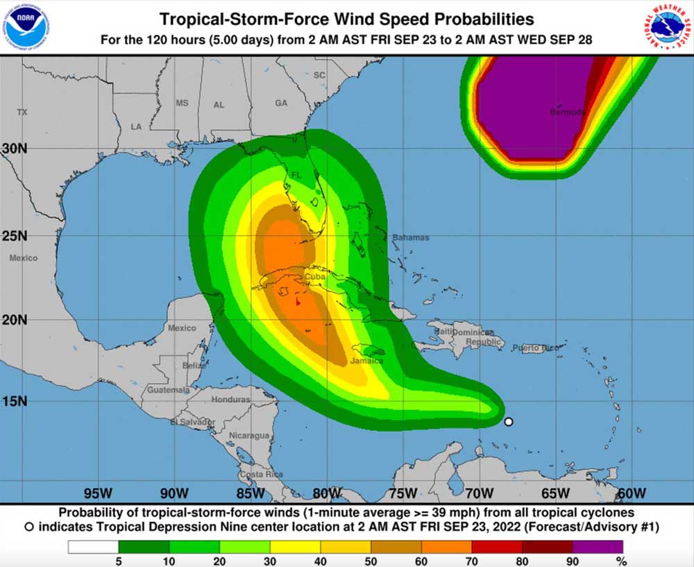
In its most recent update on Friday, September 23, the National Hurricane Center (NHC) stated that Tropical Depression 9 is currently located approximately 515 miles east-southeast of Kingston, Jamaica and 1,015 miles southeast of Havana, Cuba with 35 mph sustained winds moving west-northwest at 14 mph.
The latest NHC intensity forecast has been increased from the previous one and explicitly calls for rapid intensification as the cyclone crosses the northwestern Caribbean Sea. The system is forecast to approach the Cayman Islands and Cuba as a strengthening hurricane, with additional intensification likely once it emerges over the warm waters of the southeastern Gulf of Mexico. In fact, this forecast calls for the system to approach the Florida peninsula as a major hurricane by day 5.
NHC hurricane specialist Brad Reinhart
The storm’s five-day course shows it heading north by Tuesday over Cuba and then heading to Florida’s southwest coast as a Category 3 hurricane with 115 mph winds and gusts of 140 mph by Wednesday morning.

The “cone of uncertainty” currently includes practically all of Central Florida with landfall expected someplace between Tampa and Naples then continuing on a path that can potentially bring it up through the middle of the state.
As always, we will post any major updated information at the top of this article as they come in from the NHC.